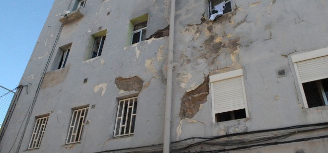
This project aims at developing a GIS-based methodology, using information available in different public databases for detecting areas in risk of energy poverty (EP), and identifying potential solutions for reducing it. To do that, this project will develop a two-stage methodology:
At the same time, this second stage will evaluate two possible strategies: the first, the potential of comprehensive energy renovations at the district level in those areas; the second, the potential of using solar installations for supplying a share of the energy demand in these areas. Both strategies will be integrated into a comprehensive methodology for facilitating the decision-making process. The methodology will be demonstrated in at least six case studies (three located in Spain; three in Portugal), considering the most representative climatic areas according to summer and winter energy poverty (SEP and WEP) risk in both countries. The project will also assess different funding schemes for implementing these solutions. https://enepomap.ehu.eus/ |